Britain finds itself in the grip of Storm Floris today, marking an extraordinary weather event that has caught many by surprise. Named storms during August are relatively uncommon, making this meteorological phenomenon particularly noteworthy. The Met Office has issued multiple weather warnings as winds reach dangerous speeds across large portions of the UK.
Storm Floris represents the sixth named storm of the 2024-2025 season, following Storm Éowyn back in January. While most people associate severe storms with autumn and winter months, meteorologists remind us that summer storms, though less frequent, can pack an equally powerful punch.
Current Weather Warnings and Affected Areas
The Met Office has escalated its response by issuing amber weather warnings for several regions, signaling a significant risk to life and property. These warnings carry serious implications, particularly the “danger to life” classifications that authorities don’t issue lightly.
Northern Ireland bears the brunt of the storm’s initial impact, with wind speeds reaching up to 50mph accompanied by torrential rainfall. Scotland faces even more severe conditions, with meteorologists predicting gusts exceeding 90mph in exposed areas. The northern regions of England are also experiencing substantial disruption as the storm system moves across the country. Yellow wind warnings remain in effect for broader areas, indicating that while conditions are less severe than amber zones, residents should still exercise caution and remain vigilant for potential hazards.
Record Breaking Wind Speeds and Impact
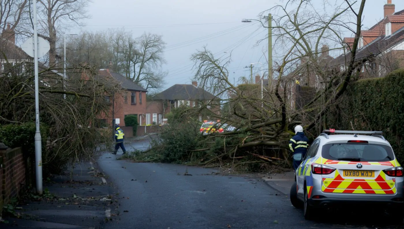
The storm has already recorded wind speeds of 108mph in some locations, creating dangerous conditions that have prompted widespread closures and cancellations. These extraordinary speeds are particularly concerning given the time of year, when trees are in full leaf and therefore more susceptible to wind damage.
Buildings across affected regions face potential structural damage, while flying debris poses serious risks to anyone venturing outdoors. Power cuts have already begun affecting thousands of households, with utility companies warning that restoration efforts may take considerable time due to ongoing dangerous conditions.
Transport Chaos Grips the Nation
Travel disruption represents one of the most significant impacts of Storm Floris, with multiple transport networks grinding to a halt. Major railway operators have implemented extensive service suspensions, particularly affecting routes between England and Scotland.
LNER, Lumo, and TransPennine Express have cancelled all Anglo-Scottish services north of Newcastle, with operators issuing stark “Do Not Travel” advisories for Monday. The East Coast main line faces complete shutdown in affected areas, stranding thousands of passengers and disrupting business travel plans.
Ferry services across the Irish Sea and between Scottish islands have suspended operations due to dangerous sea conditions. Airports are experiencing significant delays and cancellations, with several regional airports temporarily closing their runways until wind speeds decrease to safe levels.Major bridges, including key river crossings, have closed to high-sided vehicles and motorcycles. Some bridges face complete closure if conditions deteriorate further, potentially isolating communities and creating massive traffic delays.
Why August Storms Are More Dangerous
Weather experts explain that August storms present unique challenges compared to their winter counterparts. During summer months, trees carry full foliage, creating larger surface areas for wind to catch. This increased resistance makes trees more likely to uproot or lose large branches, creating hazards for roads, power lines, and buildings.
Additionally, people are less prepared for severe weather during summer. Many haven’t secured garden furniture, checked roof tiles, or taken other precautionary measures typically associated with winter storm preparation. This lack of readiness can amplify damage and create additional safety risks.
The contrast between recent pleasant summer weather and today’s harsh conditions also catches people off guard. Many planned outdoor activities, events, and travel arrangements without considering the possibility of severe weather, leading to last-minute cancellations and potential safety situations.
Emergency Response and Safety Measures
Emergency services across affected regions have moved to heightened alert status. Mountain rescue teams report multiple callouts related to hikers caught in dangerous conditions, while coastal rescue services warn against any water-related activities.
Local authorities have opened emergency shelters in some areas and are monitoring vulnerable communities closely. Care homes, hospitals, and other essential services have activated contingency plans to ensure continued operations despite power outages and access difficulties.
The public is being urged to avoid unnecessary travel and to secure loose items around their properties. Garden furniture, trampolines, and other outdoor equipment should be brought inside or firmly anchored to prevent them becoming dangerous projectiles.
Looking Ahead: Duration and Recovery
Meteorologists expect Storm Floris to continue affecting the UK throughout Monday evening before gradually moving northeastward. However, the storm’s unusual intensity means recovery efforts may extend well into Tuesday and beyond.
Cleanup operations will likely take several days, particularly in areas experiencing the most severe impacts. Utility companies are pre-positioning repair crews and equipment, though safety protocols prevent restoration work while dangerous conditions persist.