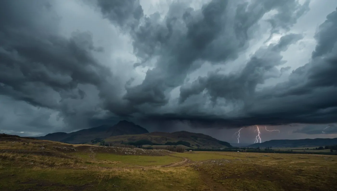
The Scotland thunderstorms weather warning has been issued by the Met Office for Wednesday August 13, 2025, covering most of Scotland with a yellow weather alert from 2pm until midnight. This severe weather event brings the potential for heavy rainfall, large hail, and gusty winds following a period of unusually hot temperatures across the UK. The thunderstorm warning affects large areas of Scotland with rainfall totals reaching 20-30mm in under an hour, and up to 50mm locally where storms repeatedly impact the same locations. Weather forecasters warn of flash flooding, lightning strikes, and transport disruption as intense storm systems move across Scottish regions, creating hazardous conditions for residents and travelers throughout the affected areas.
Met Office Weather Warning Details
The Met Office has implemented a yellow thunderstorm warning covering most of Scotland, representing a significant weather event that demands public attention and preparation. This official alert system helps residents and authorities prepare for potentially dangerous conditions.
Warning timings run from 2pm on Wednesday August 13 until midnight, providing a 10-hour window during which severe thunderstorms may develop across affected regions. The extended duration reflects meteorologists’ concerns about persistent storm activity throughout the afternoon and evening hours.
Geographical coverage includes large portions of Scotland, though specific regional variations in storm intensity are expected. Some areas may experience multiple rounds of thunderstorms, while others might see isolated but intense storm cells.
See the official notice and map for exact times and affected regions on the warning page and current news update:
- Met Office UK weather warnings page https://www.metoffice.gov.uk/weather/warnings-and-advice/uk-warnings
- Met Office update on Scotland thunderstorm warnings https://www.metoffice.gov.uk/about-us/news-and-media/media-centre/weather-and-climate-news/2025/hot-weather-continues-with-yellow-warnings-for-thunderstorms-in-scotland
Expected Weather Conditions and Impacts
Rainfall amounts present the most significant concern, with meteorologists predicting 20-30mm of rain falling within just one hour in many locations. This rapid accumulation rate can quickly overwhelm drainage systems and create surface flooding conditions.
Localized flooding becomes increasingly likely where storms repeatedly affect the same areas, potentially delivering up to 50mm of rainfall. These extreme precipitation rates can transform normally dry areas into temporary waterways within minutes.
Hail and wind accompany the most intense storm cells, with large hailstones capable of causing property damage and injury to people caught outdoors. Strong gusts may also affect driving conditions and outdoor activities.
Storms can bring rapid changes to visibility, standing water, and signal or power issues. Before you set out or head home, take a moment to check official feeds.
- Roads and trunk routes
Traffic Scotland has live incidents, webcams, and matrix sign updates
https://trafficscotland.org - Rail services
ScotRail service alterations and real time disruption board
https://www.scotrail.co.uk/plan-your-journey/service-alterations - Power supply
If lights flicker or go out, report a power cut and find status updates via your local network operator. For central and southern regions
https://www.spenergynetworks.co.uk
Temperature Contrast and Storm Development

Hot weather preceding the thunderstorm activity has created ideal conditions for explosive storm development. Temperatures reaching the low to mid-30s in eastern England, with potential peaks of 33-34°C, provide the atmospheric energy needed for severe thunderstorm formation.
Atmospheric instability develops when hot surface air meets cooler air masses aloft, creating the vertical motion necessary for thunderstorm development. This temperature contrast explains why storms often follow periods of exceptional heat.
Heat index considerations become important as high temperatures combined with increased humidity ahead of storms can create dangerous conditions for outdoor workers and vulnerable populations.
Multi Day Weather Pattern
The two day thunderstorm event extends beyond Wednesday’s initial warning period, with Thursday bringing additional severe weather risks across Scotland. The second yellow alert covers the entirety of Scotland on Thursday, indicating continued atmospheric instability.
Extended warning period reflects meteorologists’ analysis of weather patterns showing persistent storm-producing conditions. This prolonged period of unsettled weather requires sustained vigilance from residents and emergency services.
Weather system progression suggests that storm activity may shift geographically between the two days, potentially affecting different regions with varying intensity levels.
Safety Recommendations and Precautions
Indoor safety becomes paramount during thunderstorm activity, with residents advised to avoid outdoor activities during peak storm periods. Lightning strikes pose serious risks to people caught in open areas or engaged in outdoor recreation.
Driving conditions may deteriorate rapidly due to heavy rainfall, reduced visibility, and potential surface flooding. Motorists should exercise extreme caution and avoid driving through standing water.
Property protection measures include securing outdoor furniture, checking drainage systems, and ensuring emergency supplies are readily available in case of power outages or flooding.
Transport and Infrastructure Impacts
Road networks face significant disruption potential from surface flooding, fallen trees, and reduced visibility conditions. Major routes through Scotland may experience delays or closures depending on storm intensity and location.
Public transport services including buses and trains may experience delays or cancellations as operators prioritize passenger safety during severe weather conditions. Travelers should check service updates before beginning journeys.
Airport operations could face disruption from lightning activity, strong winds, and heavy rainfall affecting flight schedules. Passengers should monitor airline communications for potential delays or cancellations.
Regional Variations and Local Impacts
Urban areas may experience more severe flooding impacts due to extensive concrete surfaces that prevent natural water absorption. City drainage systems face particular stress during intense rainfall events.
Rural regions might see different impacts including agricultural concerns, livestock safety, and potential damage to crops from large hail. Farmers and landowners need to take protective measures where possible.
Coastal zones could experience additional complications as storm activity interacts with sea breezes and tidal patterns, potentially affecting coastal communities differently than inland areas.
Emergency Services and Preparedness
Emergency response teams across Scotland have been alerted to the weather warnings and are preparing for potential rescue operations, power restoration efforts, and flood response activities.
Local authorities are monitoring drainage systems, preparing sandbags where needed, and ensuring emergency communication systems remain operational throughout the storm period.
Community preparedness plays a crucial role in minimizing storm impacts, with residents encouraged to stay informed through official weather updates and local emergency management communications.
Climate Context and Seasonal Patterns
August thunderstorms represent a typical seasonal pattern in Scottish weather, though the intensity and coverage area of current warnings suggest above-normal storm activity for this time of year.
Long-range forecasting indicates this weather pattern may be part of broader atmospheric changes affecting the UK during late summer 2025. Climate scientists continue monitoring these developments.
Historical comparison with previous August thunderstorm events helps meteorologists assess the relative severity and potential impacts of current weather warnings.
The Scotland thunderstorms weather warning serves as a critical reminder of nature’s power and the importance of weather preparedness. Residents should remain vigilant, follow official guidance, and prioritize safety throughout this challenging weather period.
Trusted links for quick access:
- Met Office UK warnings
https://www.metoffice.gov.uk/weather/warnings-and-advice/uk-warnings - Met Office Scotland thunderstorm news update
https://www.metoffice.gov.uk/about-us/news-and-media/media-centre/weather-and-climate-news/2025/hot-weather-continues-with-yellow-warnings-for-thunderstorms-in-scotland - SEPA Scottish Flood Forecast
https://scottishfloodforecast.sepa.org.uk/public - BBC Weather main page
https://www.bbc.co.uk/weather - Traffic Scotland live updates
https://trafficscotland.org - ScotRail service alterations
https://www.scotrail.co.uk/plan-your-journey/service-alterations